Kilimanjaro and Mawenzi


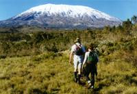
Tom, Jim & Lisa on Kilimanjaro, 19,343 feet, December 28, 1997 to January 2, 1998

Here are some photos of our trip to Kilimanjaro.  Click on any photo (except the one above) for a larger image.

Just the facts:

bulletIt took us 3 1/2 days to get to the top, 1 1/2 days down.
bulletOur beginning elevation was 6000', 1st night at 9,000', 2nd night at 12,400', basecamp at 15,400', Gilman's point at 18,800', The top at 19,343'.
bulletThe route we went up was called the Rongai Route. The route we came down was called the Marangu Route.
bulletThe starting temp was about 80 degrees F. The basecamp temp was about 40 degrees F. The top was -10 F.
bulletWe had clear blue days every morning. Clouds every afternoon. The top had a light cloud cover the day we ascended. It rained hard our fifth and last day on the mountain.
bulletWe slept in two-man tents every night even though there were huts on the Marangu route.
bulletWe had 8 porters and 2 guides taking us up the mountain. They carried all our gear and cooked and served all our meals.
bulletFood was mostly chicken, potatoes, cabbage, rice and soup. We filtered our own water but carried little as the porters carried excess water for us.
bulletNo technical gear (ice ax, crampons) were necessary.
bulletAt 18,000' we hit permanent snow and ice on the mountain.
bulletThe beginning of the trail was dense jungle, basecamp was alpine desert and the top was glacier.
bulletTotal miles on this 5 day hike was approximately 60.

Here are the photos I took:

Jim Sullivan Tom McKenna Lisa Eperjessy
Jim Tom Jim and Lisa
Jim and Lisa Jim Lisa and Tom Lisa and Jim
Rongai Route Jim, Lisa & Tom Day 3 Jim & Lisa Day 2
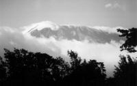
Kilimanjaro When we arrived at the hotel on December 28th, this was our first view of Kilimanjaro.
Caves Since Kilimanjaro, the largest free-standing mountain in the world, was formed by a volcano, we saw quite a few of the lava caves on our route.
Mawenzi Next to Kilimanjaro, as seen in the top photo, is the peak called Mawenzi. It's not as tall as Kilimanjaro but quite beautiful.
basecamp This is basecamp at 15,400'. We rested here on December 31st from about 2 PM to midnight.
The Top We left basecamp at 12:30 AM New Years Day so I don't have any photos of our ascent to the top. This is the top of the mountain at 19,343'. We made it from basecamp to the top in 6 hours arriving at sunrise.
Tom on the top This is a photo of me on the top. As you can see, it was quite cold. In fact, we were told later that is was -10 degrees f. And that is w/o the 20 mph of wind. We only stayed 2 minutes on the top.
Jim & Lisa on Top Jim and Lisa made it to the top in good shape. Here they are sitting next to the two guides Simon (right) and Joakeem that went to the top with us.
Kilimanjaro We had clear blue skies each day on the mountain. Here I am looking back at Kilimanjaro 6 or so hours after we were on the top.
Horumbo Huts On the way down, we spent our fourth night at the Horumbo Huts at 12,500'. These huts are found on the Marangu Route, also known as the Coca-Cola Route.
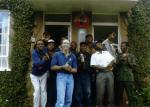
The guides and porters At the end of our trip, back at the hotel, we had a short celebration with our 2 guides and 8 porters. Here we are singing songs of Kilimanjaro.
 

Home        Photo Album        Weather      Google

Any Comments: Tom@TomandShan.com or Shannon@TomandShan.com